New Year ushered in with snowfall across Attica
Source: NEOS KOSMOS
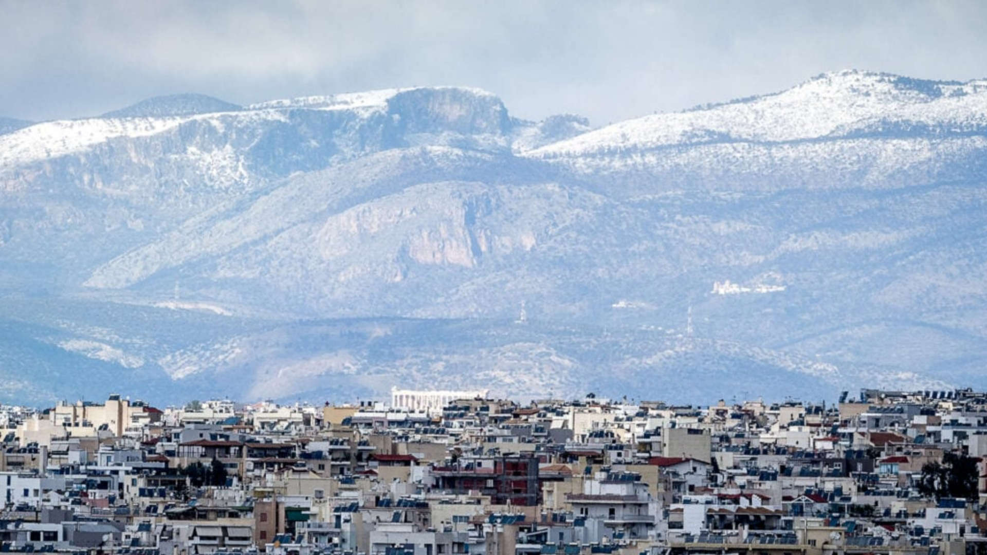
Snow, frost and intense cold are expected to accompany the New Year, with the weather forecast pointing to a distinctly wintry setting both on New Year’s Eve and on New Year’s Day. Meteorological forecasts indicate that snowfall may even reach parts of Attica.
Many parts of the country will welcome 2026 with snowflakes, which in some locations will create a white landscape, while in others they will be limited to temporary phenomena. The duration of the weather events is not expected to be long, either on New Year’s Eve or on New Year’s Day.
On New Year’s Eve, northern regions will see a few clouds, at times locally increased, with scattered rain or sleet. In the rest of the country, increased cloud cover with rain is expected, while thunderstorms may occur in the southern Aegean until midday.
Light snowfall is forecast for mountainous and semi-mountainous areas of mainland Greece and Evia. Winds will blow from northern directions at 5–7 Beaufort, locally reaching 8 Beaufort in the northeastern Aegean. In southern areas, westerly winds of similar strength will prevail.
Temperatures will drop noticeably, not exceeding 5–7°C in northern regions and 10–12°C in eastern mainland areas. In western regions and the islands of the northern Aegean, temperatures will reach 13–15°C, while in Crete and the Dodecanese they will range between 16–18°C. Frost is expected during the morning and evening hours, locally severe in northern areas.
On Thursday, New Year’s Day, a few clouds are forecast, locally increased in eastern and southern regions. Temporary rain is expected in Crete and the Cyclades, while intermittent snowfall cannot be ruled out in mountainous areas. Winds will remain northerly at 3–5 Beaufort, locally reaching 6 Beaufort over the seas.
Temperatures will remain low with no significant changes. Frost will continue in mainland areas, locally strong in the north.
Meteorologist Giorgos Tsatrafilias said that in some areas snowflakes may even reach sea level. As he noted, snowfall will not be intense, with more significant phenomena expected in Evia and mountainous regions.
In Kavala, Thassos and Samothrace, snowfall may occur even in coastal areas, while in Attica, light snowfall is expected in mountainous zones and possibly at lower elevations after the New Year’s Eve celebrations.
Meanwhile, meteorologist Theodoros Kolydas pointed out that, according to the latest ECMWF model data, the duration of the phenomena will be short. He explained that the weather pattern reflects a “clear winter scenario” without a deep low-pressure system, with the Aegean and Crete being more affected.
Rain and intermittent snowfall are expected mainly in the Aegean islands and Crete, with conditions weakening rapidly after midday on New Year’s Day.
Cold front on New Year’s Eve – indicative temperatures
Athens: 2–9°C
Thessaloniki: -1 to 3°C
Kastoria: -5 to 1°C
Trikala: -2 to 3°C
Kalavryta: -2 to 5°C
Light snowfall at low elevations
Eastern Thessaly (Pelion): above 400 m
Central–eastern Central Greece: above 500 m
Evia (Dirfys): above 500 m
Northeastern Peloponnese: above 700 m
Improvement over the weekend
According to an ERT meteorologist, weather phenomena will be limited and no major problems are expected. Possible snowfall is forecast for the northern Aegean, Thassos and the Northern Sporades.
In Attica, snowfall may occur in mountainous and semi-mountainous areas, mainly from Agios Stefanos northwards, without significant impacts anticipated.
The original article: belongs to NEOS KOSMOS .


