World’s Oldest 3D Map Found in Paleolithic Cave Near Paris
Source: GreekReporter.com

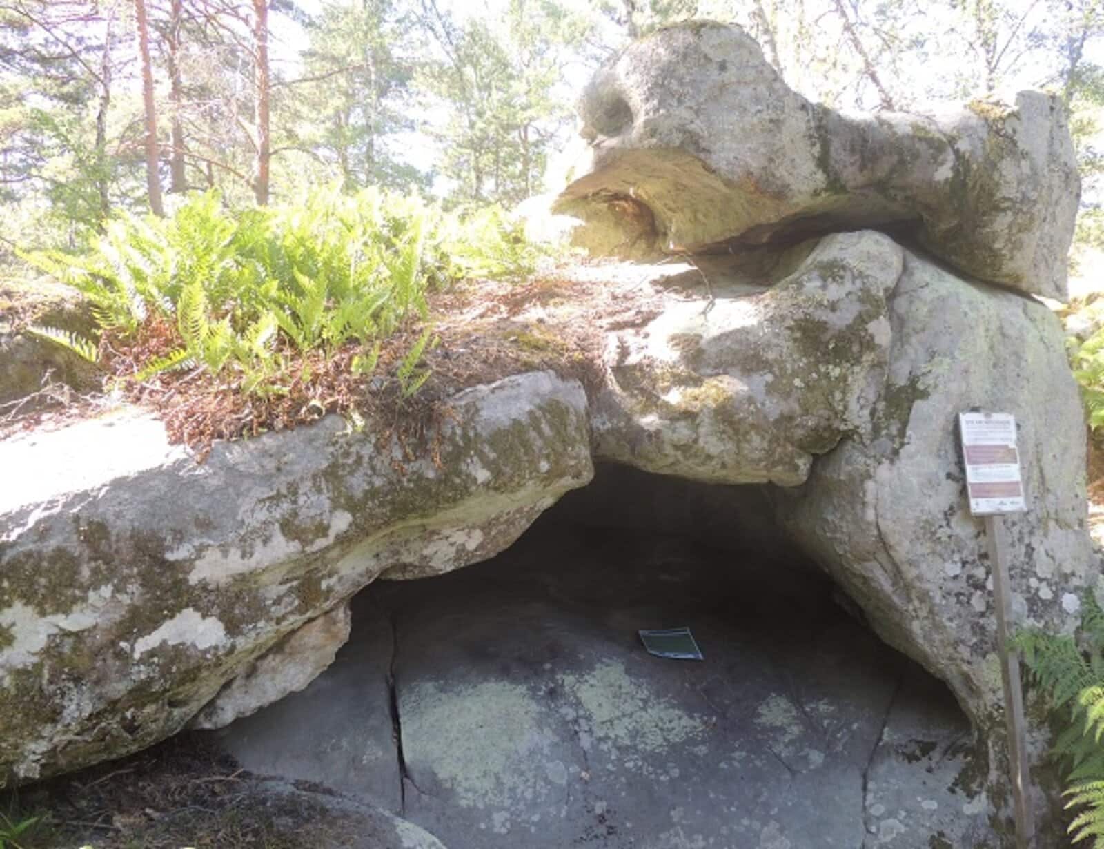
Scientists identified unique engravings that could be the oldest 3D map in the world during an investigation of the Ségognole 3 cave south of Paris, France.
The research, published in the Oxford Journal of Archaeology, explains how ancient hominins meticulously adapted the cave floor to represent the water flow in the surrounding area about 20,000 years ago. In addition to the map, archaeologists discovered engravings of horses and the human female form in the cave, suggesting the site might hold symbolic significance.
The world’s oldest 3D map, and how it works
Descubren el mapa tridimensional más antiguo del mundo en una cueva del Paleolítico cerca de París https://t.co/vcMGptjrbZ
— LBV Magazine (@lbv) January 3, 2025
The scale model of Noisy-sur-École’s surrounding landscape is on the floor of Ségognole 3 cave. The hunter-gatherers who formerly inhabited the area crafted it with remarkable precision and attention to detail. The map is a miniature representation in the back of the cave illustrating the region’s hydrological and geomorphological features.
The paper’s authors, Médard Thiry, and Anthony Milnes, describe how the floor’s surface is masterfully engraved to control water flow through accurate channels, depressions, and basins. The specific indents and inclinations in the stone represent the area’s various hills and how they correlate to the surrounding rivers, lakes, and deltas.
“The carved motifs and their relationship with natural features in the sandstone of the shelter can be compared with major geomorphological features in the surrounding landscape,” the researchers write in the paper.
This is the culmination of research into the cave’s engravings starting in 2020. Thiry and Milnes initially observed the significance of the water’s movement, discovering that water passing through the cave’s grooves eventually collects in a depression resembling a vulva. Other paths manipulate water to travel through alternate routes. They described rainwater entering through small surface cracks adapted to receive direct precipitation from the push of the wind.
The carvings and natural cracks as a whole represent both the surrounding landscape and the female body.
“The natural geomorphological characteristics of Ségognole 3 shelter thus provided appropriate disposition to imprint this fragmented representation of feminity, a theme that shows clear importance during the Upper Palaeolithic,” the researchers said about the Ségognole 3 cave in the 2020 paper. “While the hydraulic mechanisms seem at first glance to be complex, ongoing water gathering experience, observation of water flows interacting with regional sandstones, and familiarity with the shelter and its environment could well have sharpened the intuition and understanding of those who were responsible for it.”
The combination of the representation of horses, the female figure, and the region’s map is remarkable. They demonstrate a high level of understanding and intelligence in the paleolithic hominin population that once resided in Noisy-sur-École.
The original article: belongs to GreekReporter.com .
